C A R T O G R A P H Y
From a young age, I held a fascination with spatial relationships, which led to a study of Geographical Information Systems (GIS), cartography, and remote sensing. I gained extensive experience working on a wide array of mapping projects at various cartographic agencies before shifting my focus to publishing, where I held positions and undertook projects across several major publishing houses.
In addition to designing and creating maps, I also specialize in editing, briefing, and ensuring the accuracy of all things spatial.
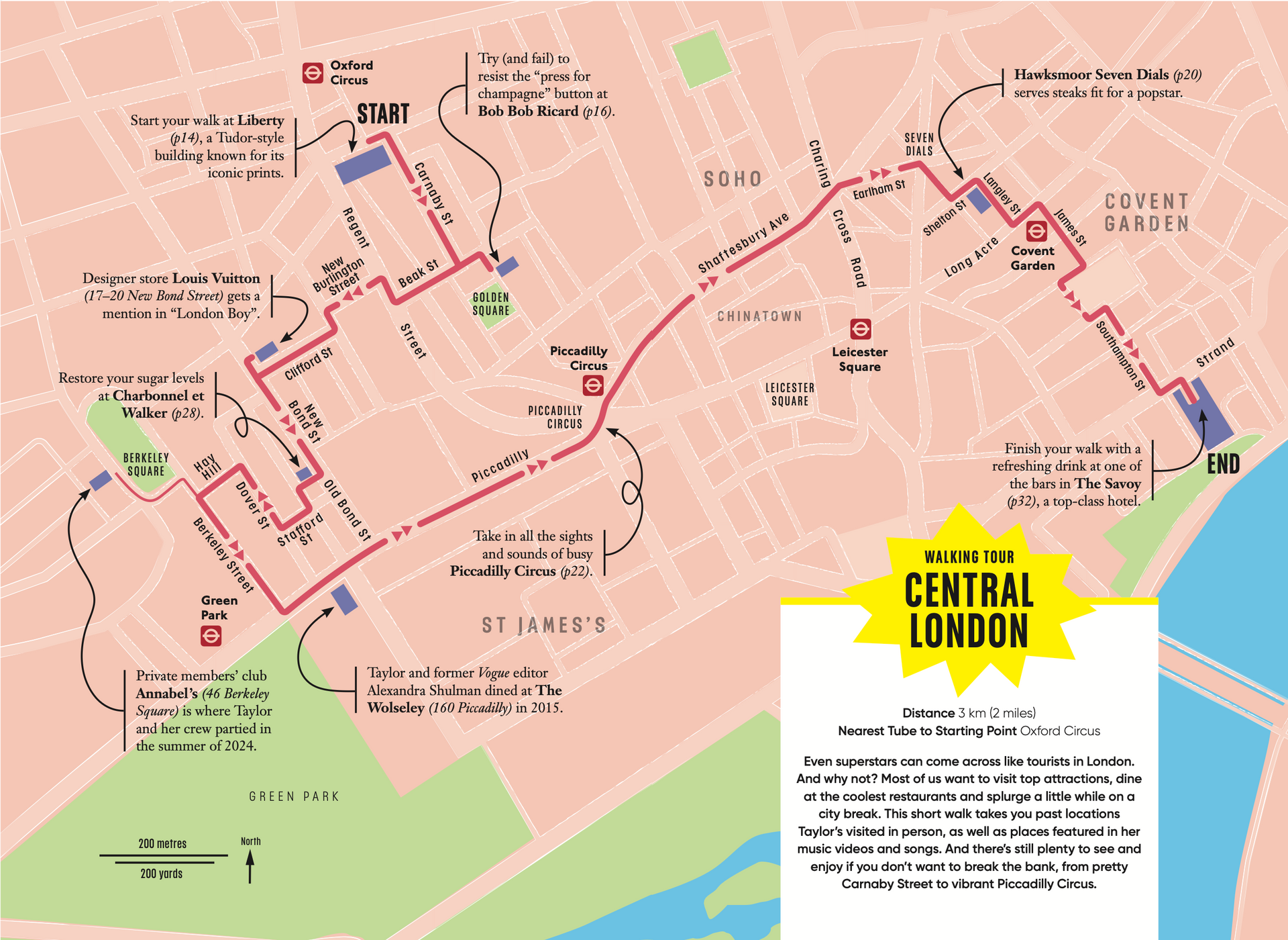
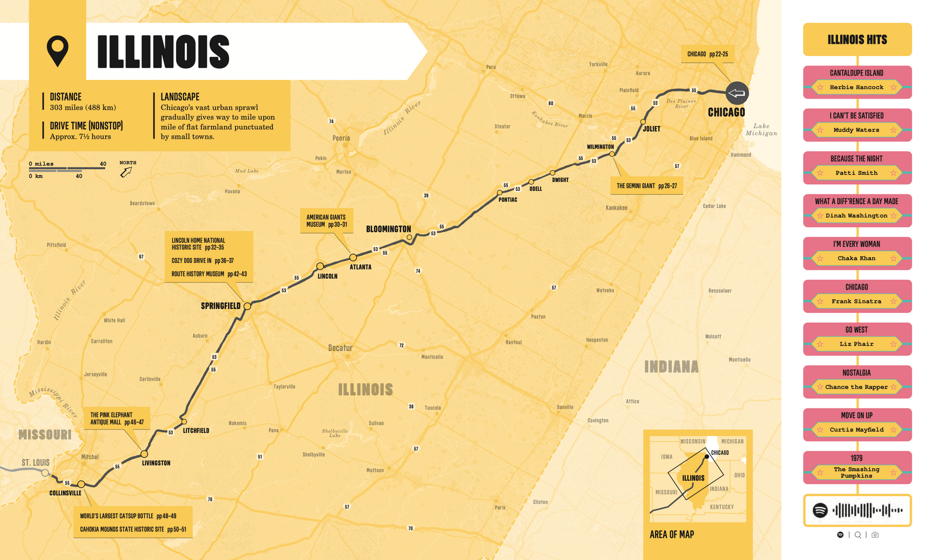
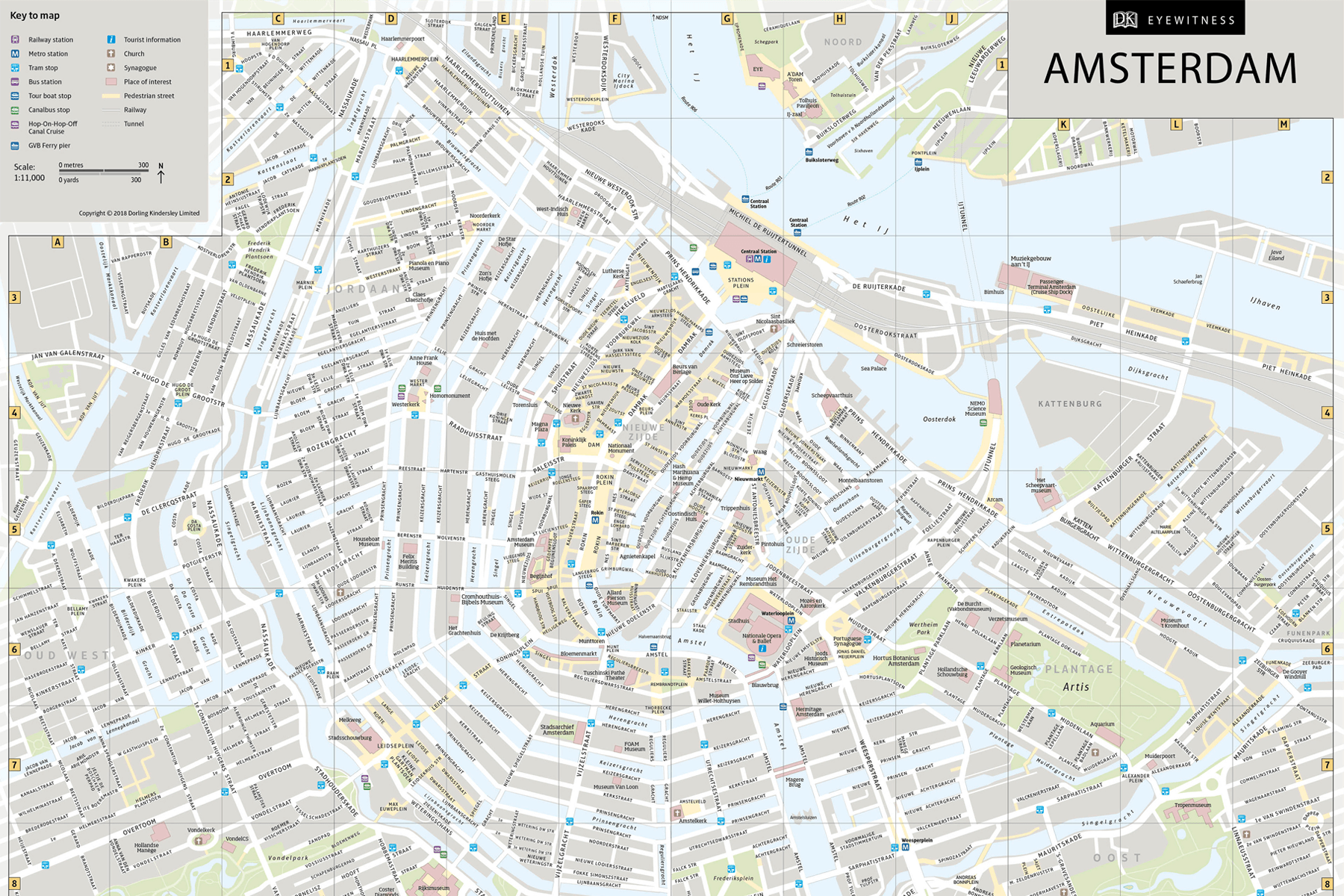
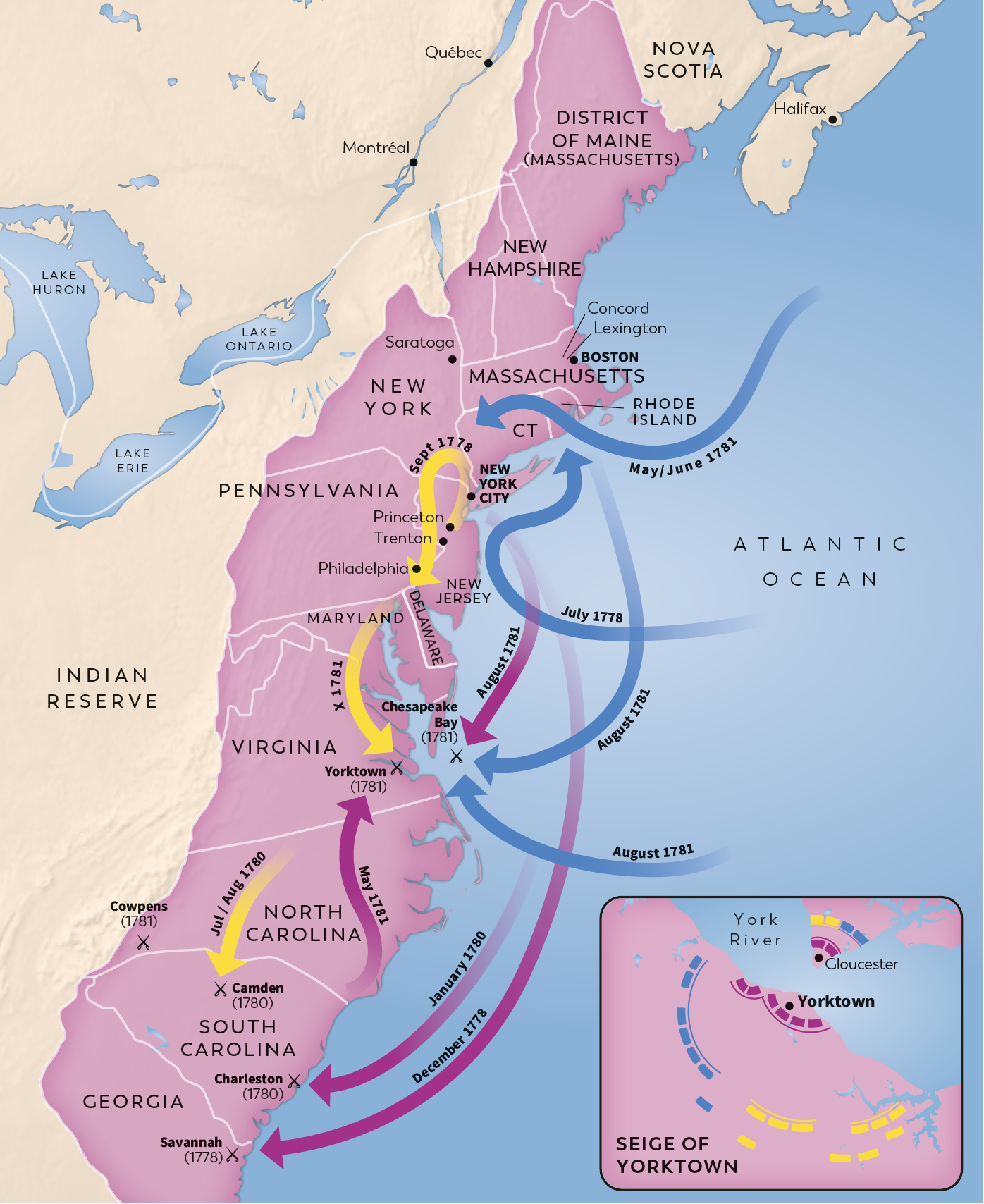
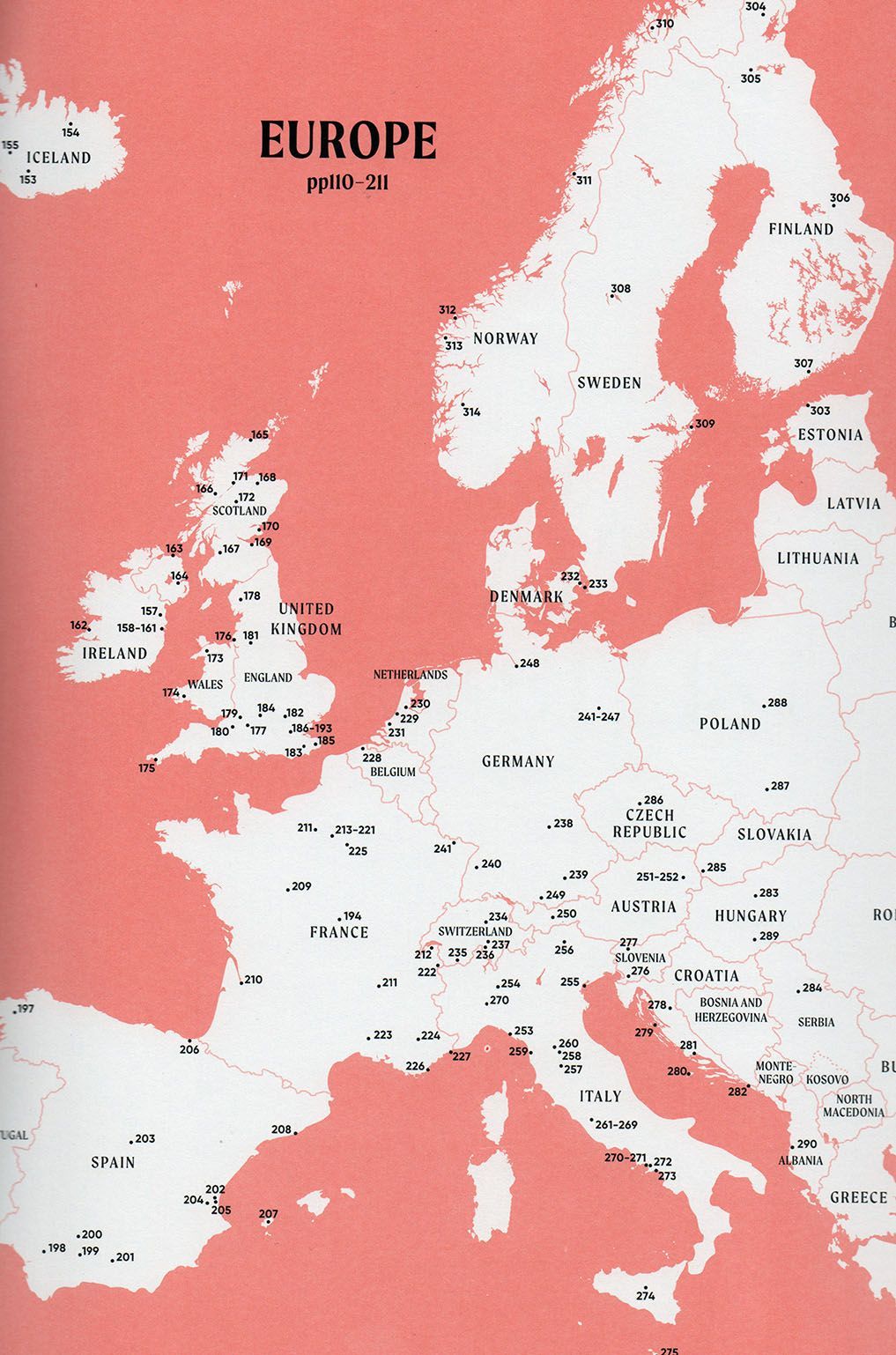
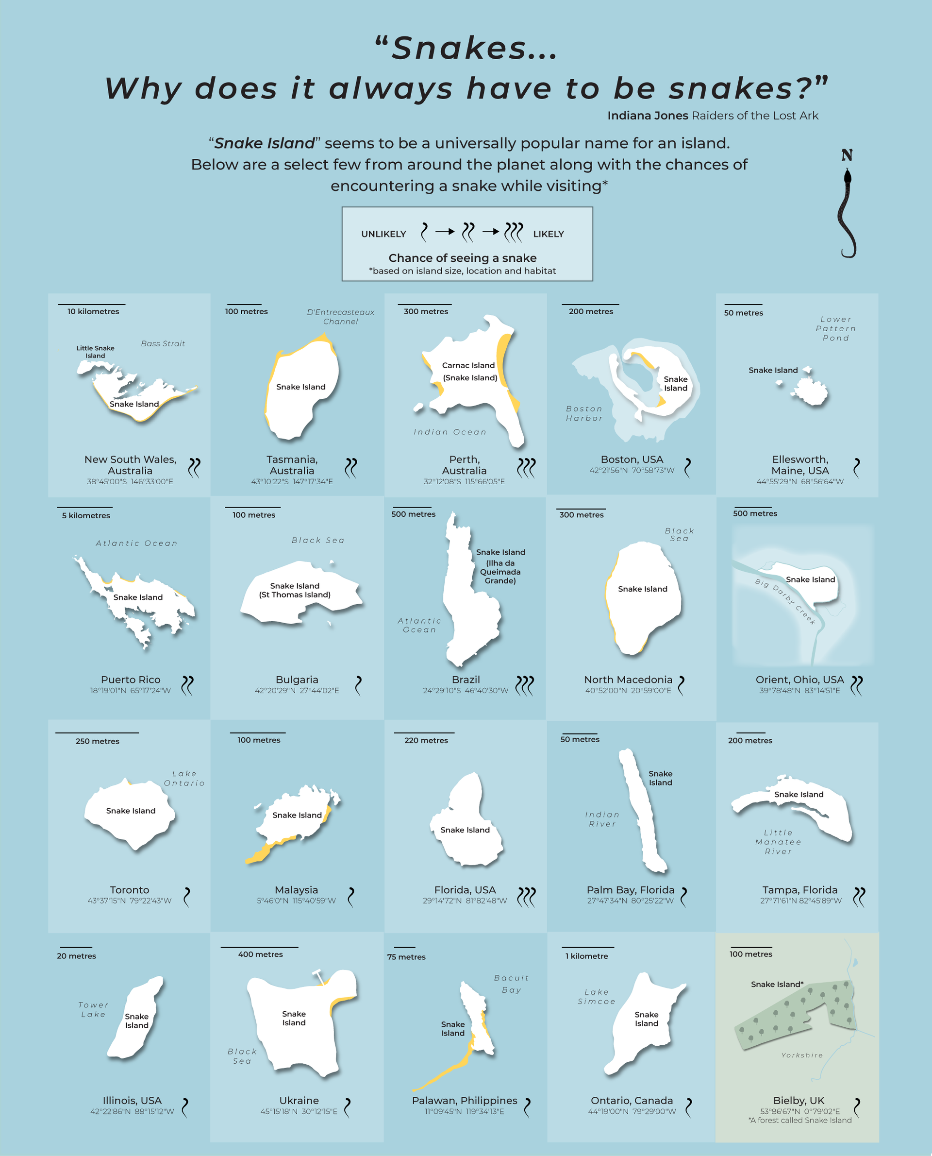
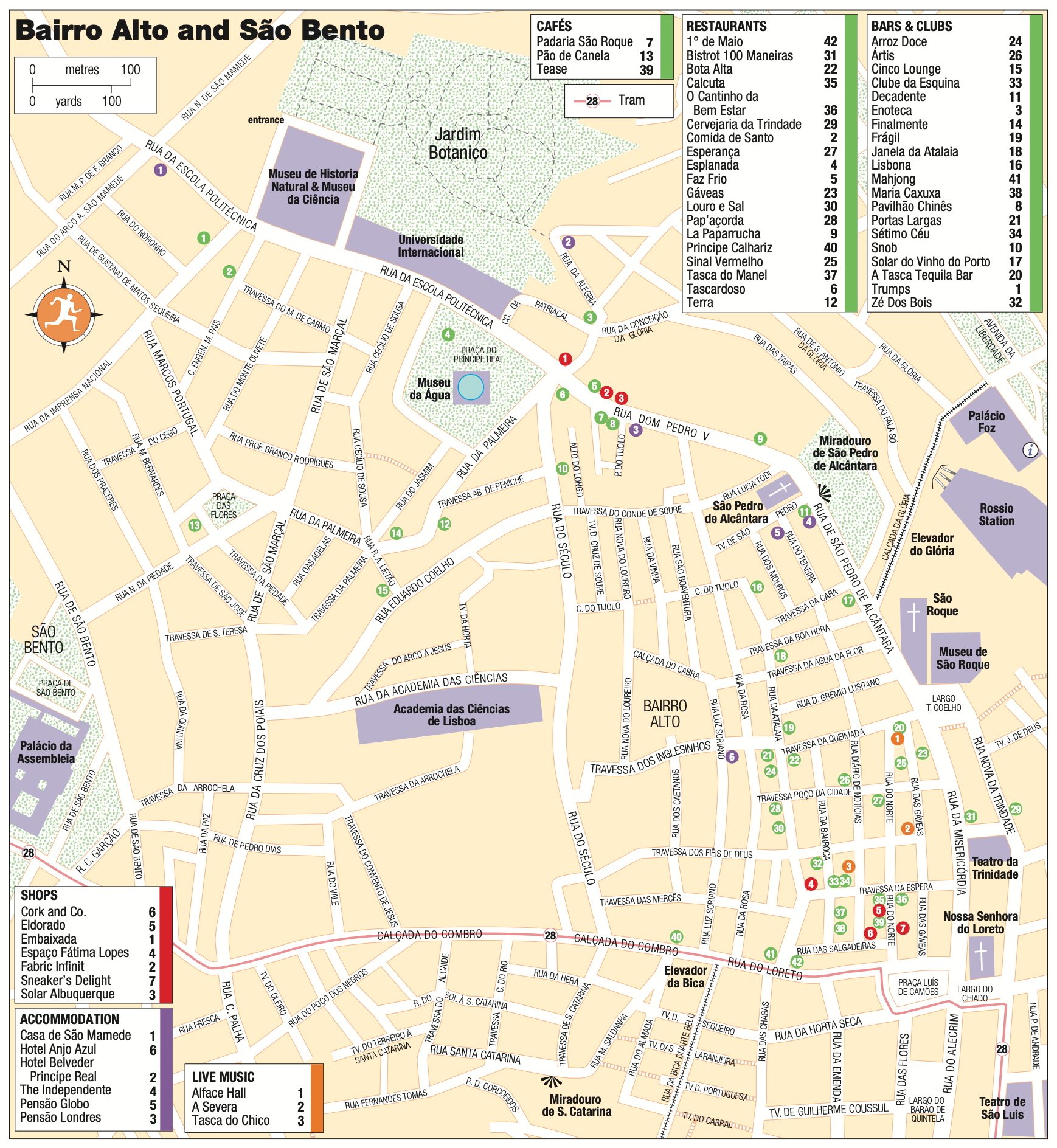
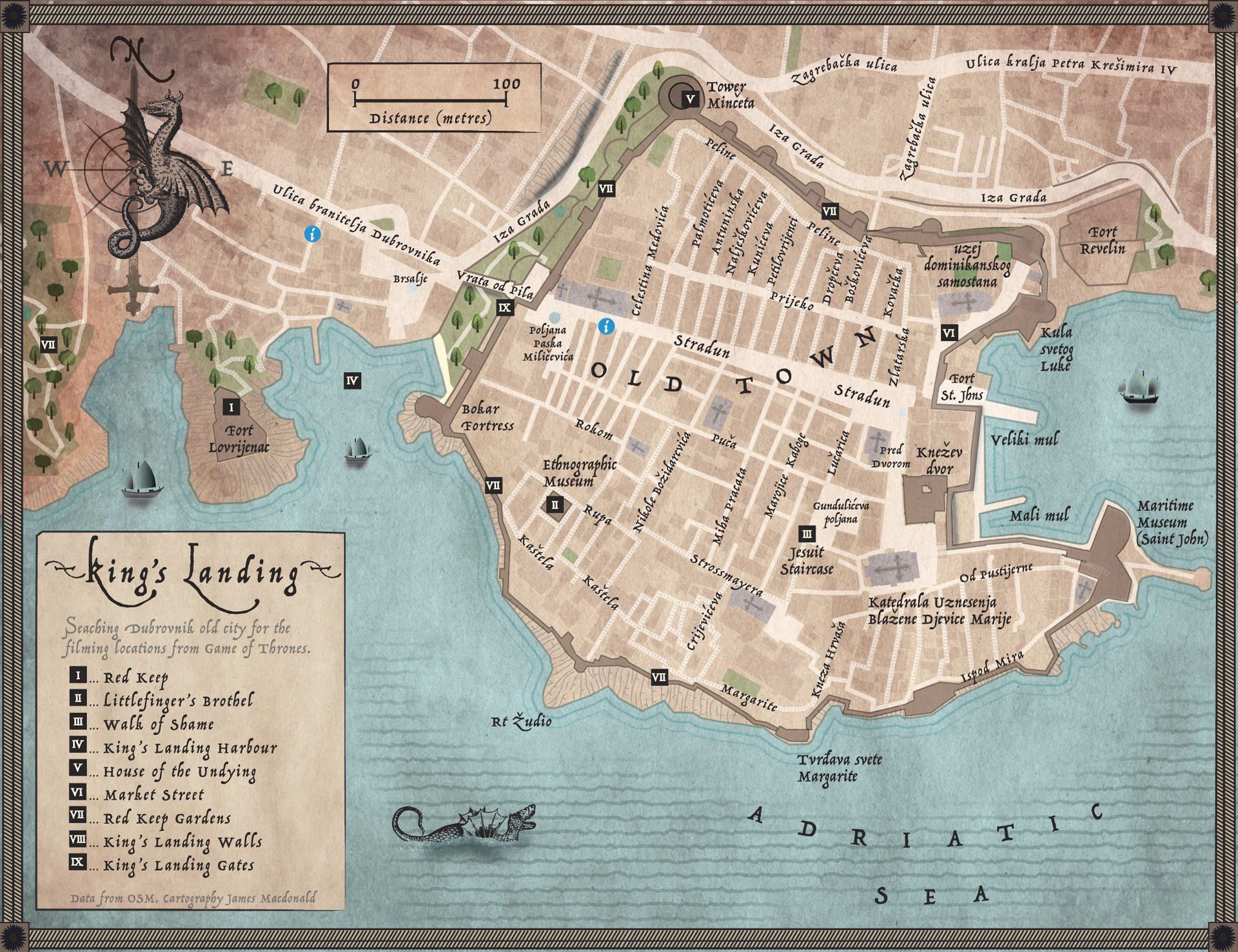
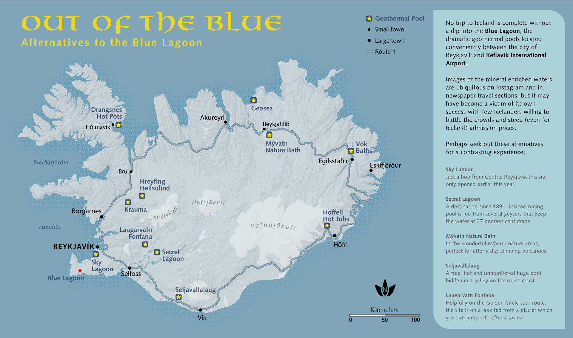
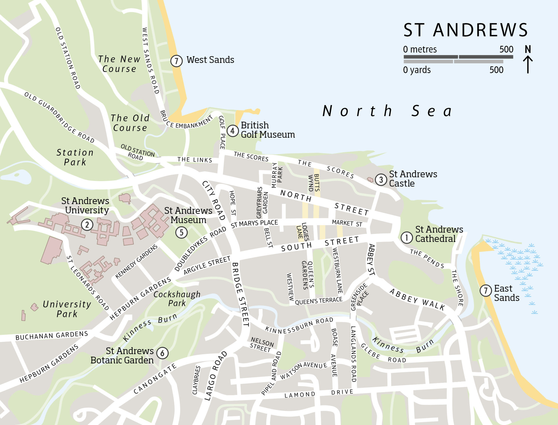
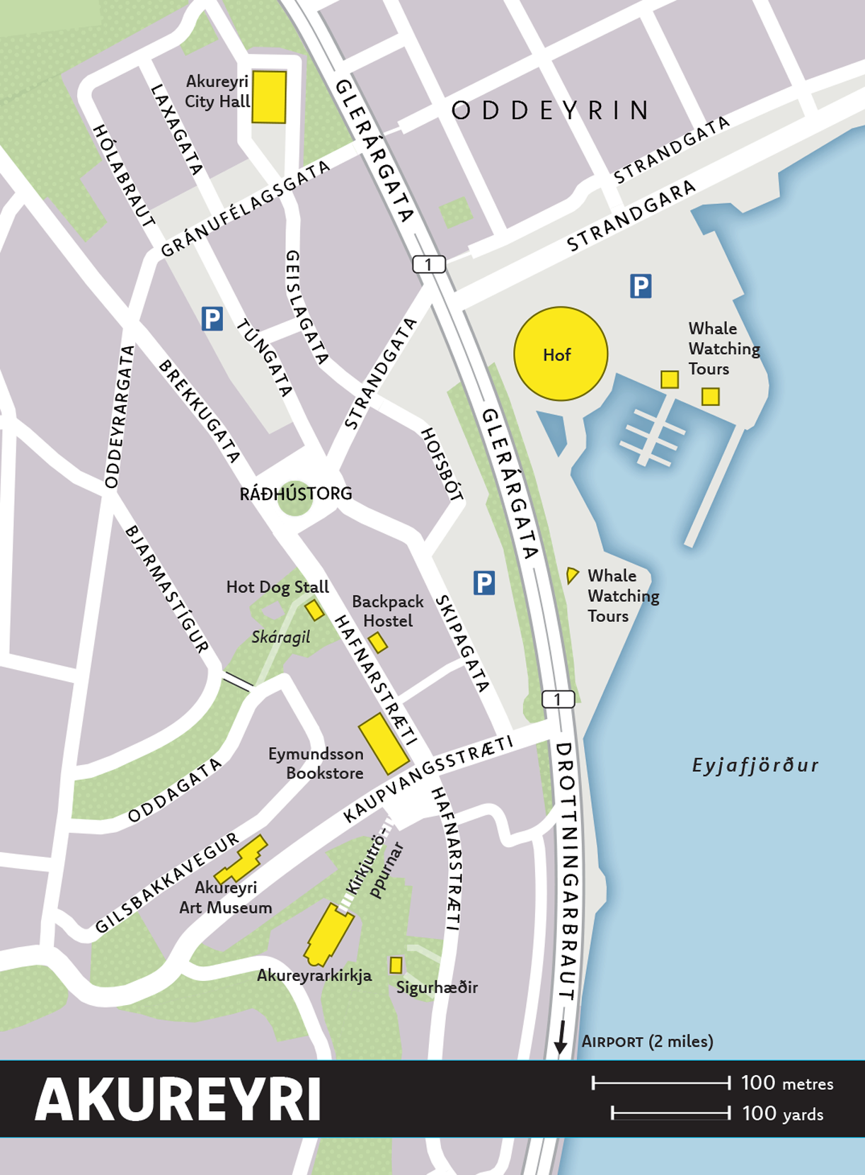
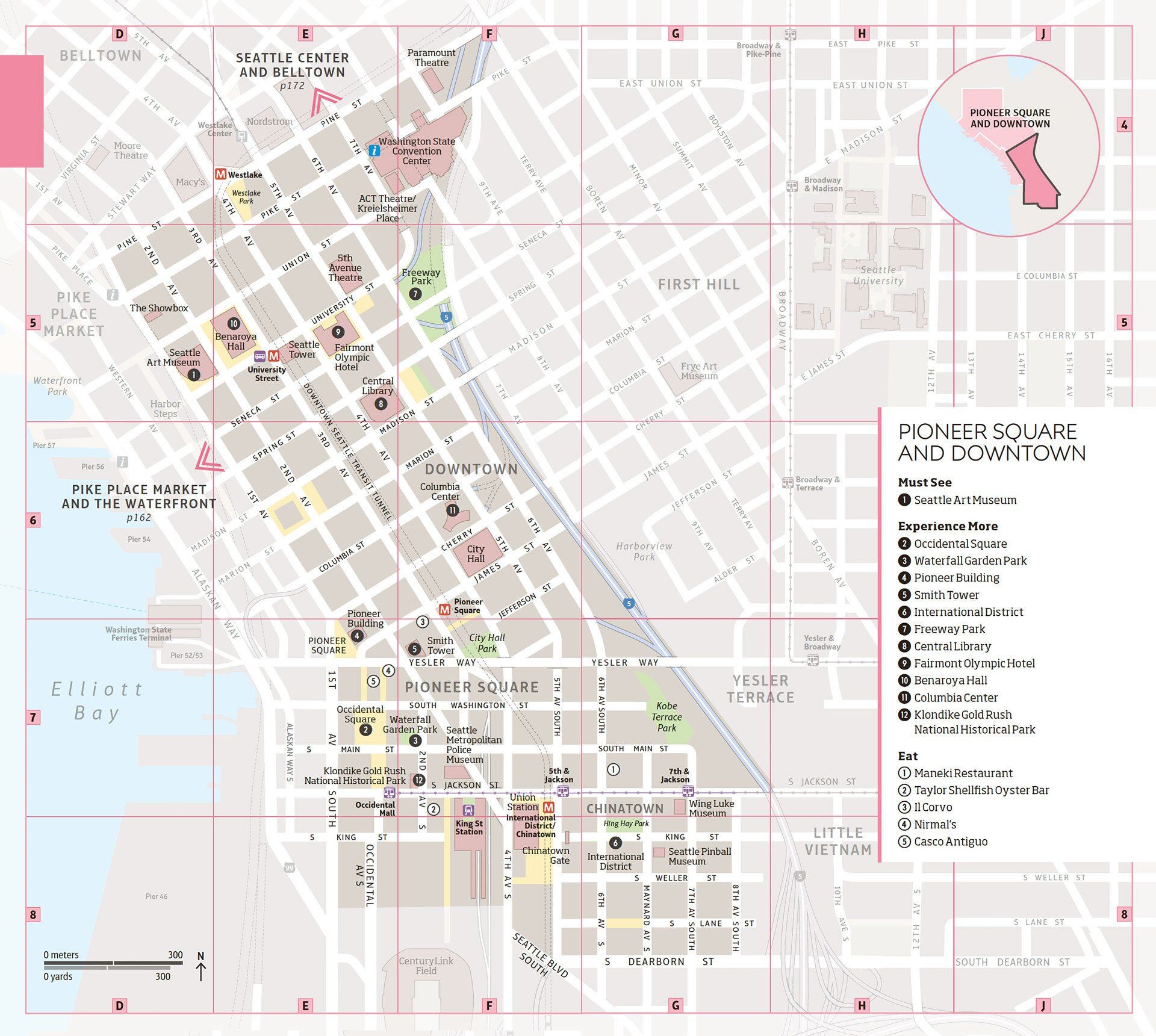
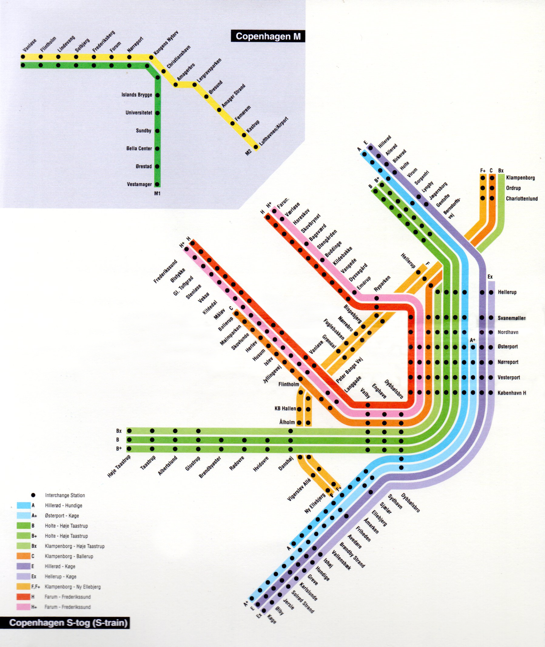
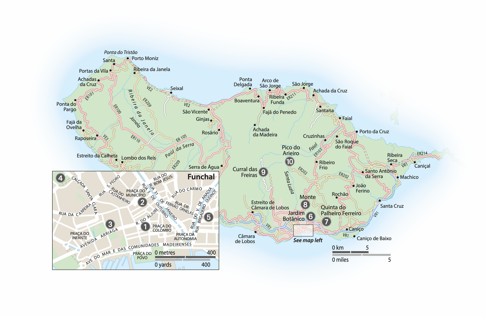
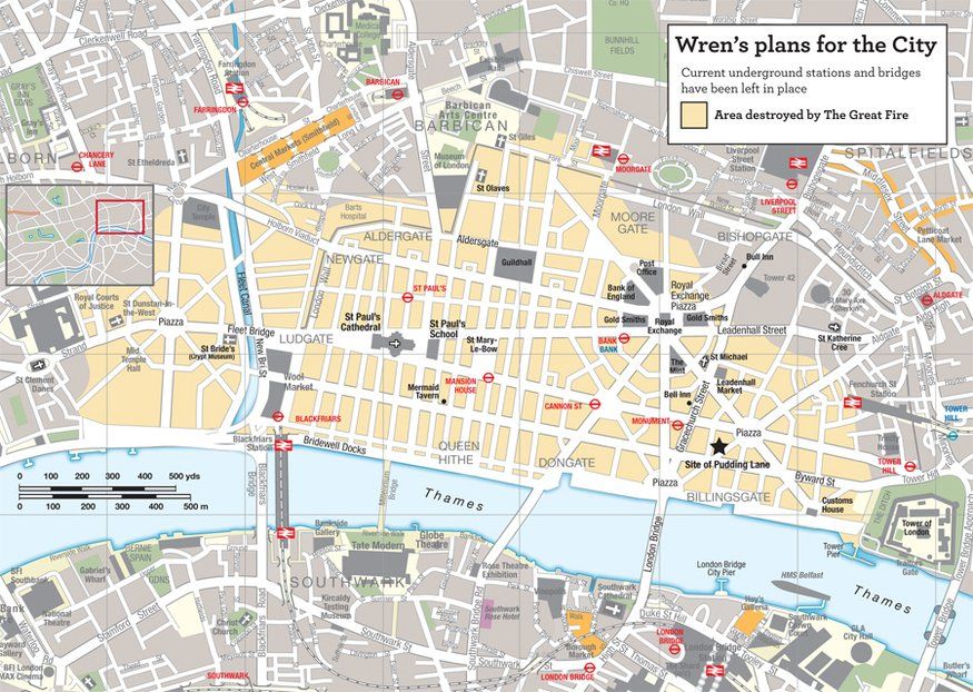
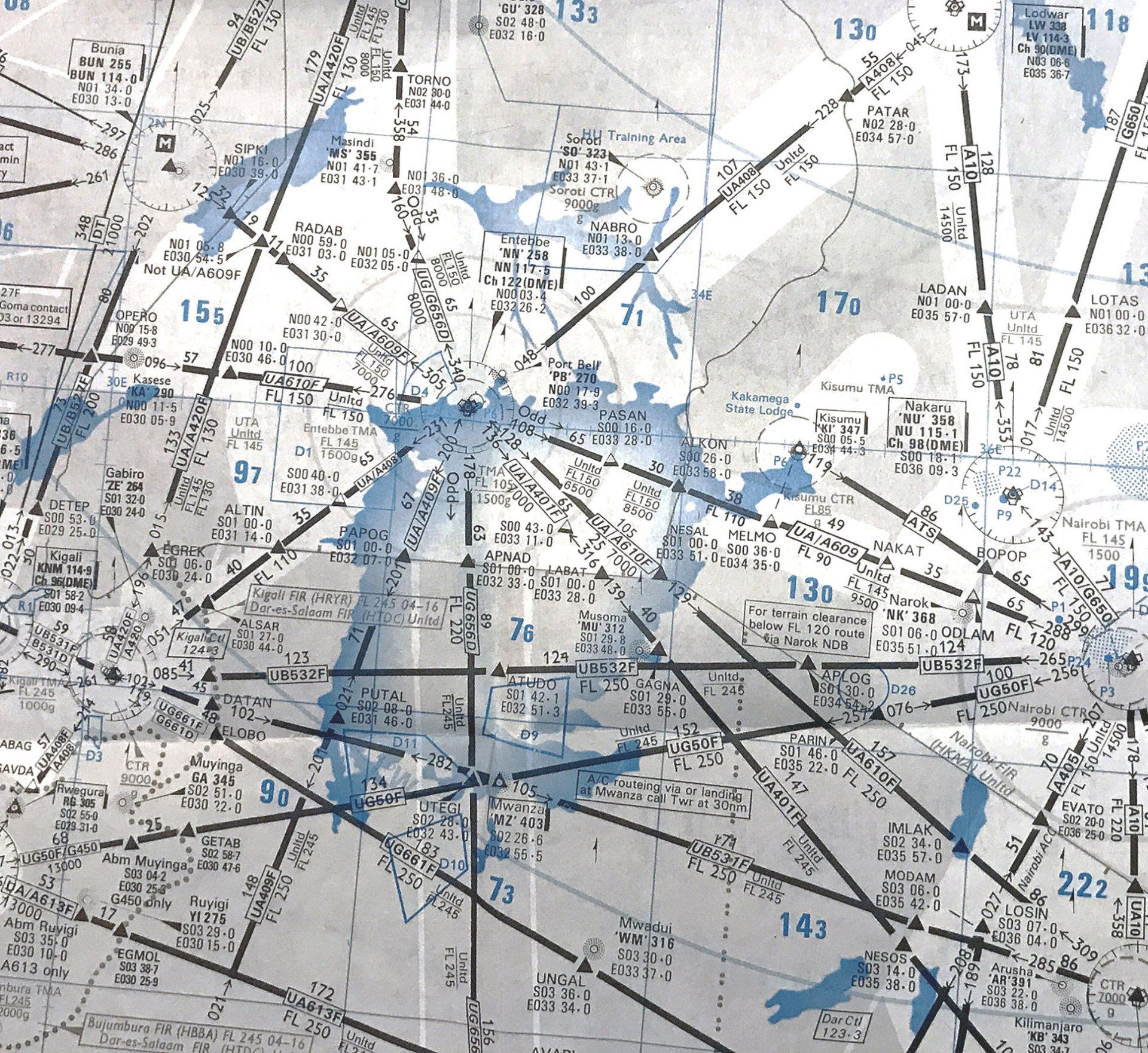
I have produced countless maps and graphics for organizations such as DK, Rough Guides, Penguin, Insight Guides, Berlitz Guides, the Londonist, and Reader's Digest.


Note: The copyright and ownership of images above remain property of their publishers.